
Local News
As we come to the end of another fantastic snowy year in Utah, here is the most recent flood forecast for the spring melt
By 
Editor-in-Chief
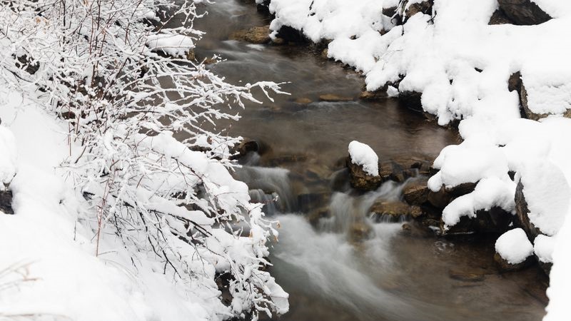
Salt Lake City, Utah – Following an unprecedented snowfall and water year in the previous winter, this one proved to be even better, with above-average snowfall in all of Utah’s basins by the end of the season.
More significantly, on April 2 of this year, the snow water equivalent (SWE) reached its peak at 18.8 inches. This indicates that there would be little less than 19 inches of liquid water if all of the snow melted. We had almost three liquid inches of water above the typical, which is sixteen inches.
Although experts are now not overly concerned about the flood risk in Utah, as we go into the warmer season, there is a concern that liquid water may emerge when the snow melts. Based on the most recent snowpack and SWE statistics, the reservoirs should be able to manage the runoff from the melting snow, but Mother Nature has the last word. Locally, the risk of flooding may grow if there is a significant temperature increase or if there is heavy precipitation on top of the melting snowpack; however, this would be noted in the short- to medium-range forecast.
In an ideal world, highs would gradually rise to mild levels in the afternoon, and nightly lows would return to freezing in the highlands, reducing the chance of flooding. This permits runoff to gradually seep into the reservoirs via rivers, creeks, and streams. In addition to prevents a lot of rain from falling directly on top of the snowpack, which could accelerate water runoff and enhance snowmelt.
Except for Lake Powell and Flaming Gorge, Utah’s reservoirs are currently 85% full as of April 15. Compared to the same time last year, there is 30% greater capacity here.


Leave a Reply